Kentucky Division of Water (DOW) Water Maps Portal
Portals, Viewers and Story Maps 2.0
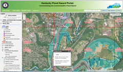
Flood Hazard Portal
The Flood Hazard Portal provides a source for all of the Commonwealth's floodplains. Use this application to view the floodplains throughout the State. In selected counties, you can also download the floodplain models used to create the floodplain elevations and determine the floodplain elevation at specific locations within the floodplain.
Click here or on the map icon to enter the Flood Hazard Portal.
Water Health Portal
The Water Health Portal is a "one-stop-shop" for all of the Commonwealth's water health information. Determine the status of surface water uses near your location from swimming to fishing to drinking water; connect to studies and reports on various streams; and identify Kentucky's "Outstanding State Resource Waters.
Click here or the map icon to enter the Water Health Portal.
NOTE: The Water Health Portal performs best when using one of these web browsers: Google Chrome, Firefox, or Safari.
KY Watershed Explorer
The Kentucky Watershed Explorer offers a wide variety of information regarding the Commonwealth's Watersheds. Users can toggle on and off map layers to customize the map view. Data layers include: River flow data, DOW KPDES Permitted Facility locations, water withdrawal sites, Karst trace flows, and more.
Click here or the map icon to open the Watershed Viewer.
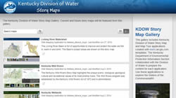
Story Map Gallery
This gallery includes Kentucky Division of Water Story Map applications created with esri's arcgis.com templates. The Kentucky Department of Environmental Protection Information Section collaborated with the Division of Water to prepare the content for each application.
Click here or on the Story Map Gallery icon to go to the Gallery.
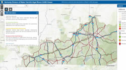
HAB Viewer
The Kentucky Harmful Algal Bloom (HAB) Viewer provides the latest information on the status of HAB recreational health advisories in the Commonwealth. Advisories are based on potential public health risks from algal toxins found in Kentucky’s lakes and rivers.
Click here or on the map icon to go to the HAB viewer.
Forestry - Special Use Waters
The Special Use Waters (For Forestry) Viewer provides information regarding waters of the Commonwealth with unique characteristics that afford them special protections. This application allows users, specifically the forestry industry, to determine the special use designation of the bordering or receiving waters to their area of interest.
Click here or on the map icon to open the application and learn more.
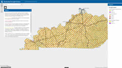
Drought Viewer
The Drought Viewer allows the public to see current drought conditions by county, and provides detailed information on the severity of drought conditions. Drought Action Levels are defined using both physical measures of climatic, hydrologic or agronomic factors and reported impacts and are used to determine the involvement by state agencies. Water Shortage Watches and Warnings are intended to encourage increased awareness by water supply managers and help local governments communicate the severity of the drought situation or that a critical water shortage is imminent.
Risk MAP Portal
Here, you will find interactive maps and resources to visualize the flood risk in your area, access supporting data, and learn more about the status of ongoing flood studies in Kentucky.
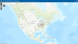
Well Driller Locator
The Well Driller Locator allows interested parties to find contact information (based on business location) for a drilling company certified to operate in Kentucky. Click here or on the Well Driller Locator icon to go to see who is certified to operate in Kentucky.
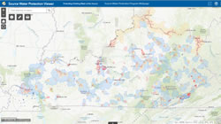
Source Water Protection Viewer
The Source Water Protection Viewer was compiled as a service to the public and public water systems using information from a variety of sources. Data, information, reports and maps on this viewer are for informational purposes only and are subject to revision or correction at any time. The data, information, reports and maps are not official documents. THis viewer is not intended to be used for regulatory or other decision making purposes. Any visitor to this site uses it at their own risk.
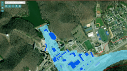
Dam Inundation Viewer
The Kentucky Dam Inundation Area Viewer is designed to help property owners, local municipalities, and other interested stakeholders to determine if properties of interest may be impacted by the failure of a high hazard dam regulated by the Kentucky Division of Water. The viewer includes locations of regulated high hazard dams, modeled inundation areas, building footprints that fall within the inundation areas, and the FEMA National Flood Hazard 1% flood risk areas.
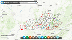
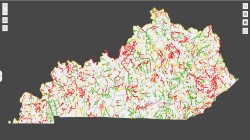
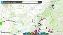
Special Waters Viewer
Special waters are waters listed in Kentucky Administrative Regulations (KAR) that are worthy of additional protection. The Special Waters Viewer provides information on waters with a higher designated use category (Cold Water Aquatic Habitat or Outstanding State Resource Water) as promulgated in 401 KAR 10:026 or with a higher antidegradation category (Outstanding National Resource Water or Exceptional Water) as promulgated in 401 KAR 10:030. Reference reach waters and waters that support federally-listed threatened or endangered species are also indicated. In addition, any candidate waters for the above categories are shown from the time of proposal until the promulgation process is complete. If no candidate waters are shown, then none are currently proposed. This viewer will assist the user in determining the additional criteria (401 KAR 10:031) or the antidegradation requirements (401 KAR 10:030) applicable to a special water of interest.
Well (GW) Record Information Viewer
This Well (GW) Record Information Viewer is for use with DEP Uniform Kentucky Water/Monitoring Well Reporting Record.
Water Quality Certification Viewer
The Water Quality Certification Map Viewer will assist you in verifying authorization for your activity under a General Water Quality Certification or if an Individual Water Quality Certification is required.
Integrated Report Hubsite
The Integrated Report Hubsite has the latest updates for the Integrated Report to Congress on the condition of water resources in Kentucky. The current data is reflecting the 2022 cycle.

Kentucky PFAS Explorer
The Kentucky Division of Water samples drinking water, surface water, groundwater and fish tissue for PFAS. This application presents information and resources to explain these data and allows users to download the raw data for further analysis.
Kentucky Public Notice Viewer
The Division of Water ‘s Public Notice Viewer for Kentucky Pollutant Discharge Elimination System (KPDES) and other wastewater permits, Water Quality Certifications (WQC), State Planning and Environmental Assessment Reports (SPEARs) and environmental findings associated with State Revolving Fund (SRF) funded projects through documents for Findings of No Significant Impact (FONSI).

Kentucky Drinking Water Service Line Inventory
Lead can enter drinking water when service pipes and plumbing fixtures that contain lead corrode, especially where the water has high acidity or low mineral content that corrodes pipes and fixtures.
The Lead and Copper Rule Revisions have requirements for locating and removing lead pipes. Public Water Systems are required to submit an inventory of all service lines classified as non-lead, unknown, galvanized requiring replacement, or lead.
This viewer displays the results of these inventories.
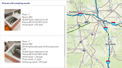
Kentucky's Lead in Drinking Water Reduction Program
Kentucky’s Lead in Drinking Water Reduction program offers schools and childcare facilities free lead testing and gives educational and remedial guidance for reducing potential lead exposure in drinking water from those facilities. This viewer shows the results of this ongoing effort.
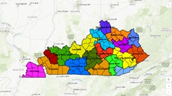
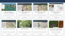
Kentucky Public Water Systems Interconnections Maps
These interconnect maps have been developed using data from the Energy and Environment Cabinet's GIS Layer Database, WRIS, and institutional knowledge. This is intended to be a living document and updated as new information is obtained or new interconnects are created. All usage data was developed using 2023 reported water withdrawal data, unless otherwise noted.